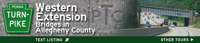
| Home > Tours > Pennsylvania Turnpike in Allegheny County | |||
|
|
Success Begets Successors In its 1939 report to Congress, the U.S. Bureau of Public Roads predicted the soon-to-be-completed Pennsylvania Turnpike would only net 715 vehicles per day. The tollgates opened at a minute past midnight on October 1, 1940 and by the close of the year Turnpike traffic had surpassed the BPR estimate by nearly 500,000. Conquering what early explorers termed the Endless Mountains, the original length of America's First Superhighway stretched 160 miles from Middlesex in Cumberland County (16 miles west of Harrisburg) to Irwin in Westmoreland County (22 miles east of Pittsburgh). Though wartime restrictions intervened, the economic benefits and improved convenience were plainly seen. When civilian traffic levels resumed in 1945, planning began on extending the now-proven concept. Financing had been harder to attract in 1939, but by 1947 capital was flowing on success; Governor James Duff was able to sign a law that wrapped up funding for the original highway along with proposed eastern and western expansions. The Philadelphia Extension (Carlisle-Valley Forge) added 100 miles to the east in November of 1950. The Western Extension broke ground on October 24, 1949. Financed with $77.5 million in bonds, the 67-mile extension was built by 18 firms under 27 contracts. Eager to tie into new highways being built eastward out of Pittsburgh, the portion from Irwin to Monroeville opened August 7, 1951. Ohio was lagging by 3 years on its Turnpike construction, so the little town of Petersburg received a gift of increased traffic when the Western Extension was opened fully to the Gateway interchange, the day after Christmas 1951. Geology and Topography Influence Route Planning The Western Extension traverses 30 miles across Allegheny County. As pioneer settlement moved westward, it is natural to trace the Turnpike in this direction (though modern convention is to measure mileage beginning in the west and south). A relief map of south-central Pennsylvania is striking in its gently arcing, parallel folds. The Appalachian Mountains challenged the 1883-1885 South Pennsylvania Railroad's attempts at constructing a route across the southern tier of the state; the railroad's six partially finished tunnels were incorporated into the Turnpike. In the Ridge and Valley Province (Newburg-New Baltimore), the highway established a pattern of following each valley floor for distance until the trend necessitated burrowing through a mountain fold to reach the next valley. Once passing the Allegheny Front at New Baltimore, the topographical folds begin to space out in frequency. The anticline at Laurel Hill required the westernmost tunnel (now bypassed), a descent across the Ligonier Syncline, then a twisting cut over and through the Chestnut Ridge anticline; beyond this, the rhythm of anticline and syncline become fading echoes as the forces of erosion take prominence. [Listing of anticlines and synclines] West of Chestnut Ridge, the Pittsburgh Plateau begins a gentle northwesterly descending trend. Subsurface the folding continues, but what appear to be hills and valleys are all the result of eons of streams carving through the soft sedimentary rock layers. Stream Valleys Entice with Gentle Grades Native American paths were noted for following high ground and ridgelines; modern planners followed stream valleys in search of gentler ascents and descents. It had been so for railroads and it would be so for modern highways. The original Turnpike terminated at the Lincoln Highway in Irwin. It was from this point that engineers would begin a route connecting to Ohio. Once obliquely crossing Brush Creek, the highway follows Byers Run and Lyons Run to reach Allegheny County. Crossing Turtle Creek, an apparent geological weakness fortuitously shows by aligning McClintock's Run almost directly opposite. This begins a gentle upward climb across Monroeville, over high ground (which not coincidentally crosses two major Native paths) before aligning with Plum Creek to reach the Allegheny River. The Turnpike maintained a high level crossing over the river on a 2,180-foot-long deck truss bridge, replaced in 2010. On the opposite shore, powerful Deer Creek created a valley leading to Cedar Run, trending yet more northwesterly. The highway route reaches high ground at Middle Road (which follows ridgelines) and maintains its elevation to cross the Willow Run Viaduct. The path continues along Montour Run, over a crest at Babcock Boulevard, along Pine Creek, another crest at Graham Road, before descending again. From this point, the Turnpike leaves Allegheny County to follow Brush Creek deep into Butler County as the road continues toward Pennsylvania's Northwestern Glaciated Plateau and Ohio. Effect of the Turnpike on Suburban Allegheny County A cursory comparison of the areas surrounding each Turnpike interchange in Pittsburgh's suburbs shows the impact of the highway in their development. This is especially evident when looking at each intersecting roadway. The Lincoln Highway, US 30, was a major east-west route across Pennsylvania. Although the Turnpike provided a safer alternate over the mountains, this alternative ended as traffic rejoined the Lincoln at Irwin. From 1940 to 1951, the majority of cross-state traffic through Pittsburgh followed the Lincoln Highway: the character and density of the buildings indicate a surge in response to this period of additional traffic. Meanwhile, the Pennsylvania Department of Highways (now PennDOT) had completed the Penn Lincoln Parkway East (1958, extended 1962) and two rounds of widening William Penn Highway (1941, 1957) through Monroeville. The former Patton Township was inundated with traffic, commerce and nearly 40,000 new residents Just outside of northern Allegheny County, the Perry Highway Interchange at US19 transferred a steady but not overwhelming flow of traffic between the Turnpike and the main connecting route between Pittsburgh and Erie. Even after local completion of Interstate 79 in 1976, including a cobbled interface with the Turnpike via US19, Cranberry Township continued to be a sleepy, rural area. It was not until Interstate 279 linked downtown Pittsburgh -- creating a convergence with US19 and I-79 at the Turnpike --that the real estate boomed. Adding in the lower taxes of rural Butler County, Cranberry Township was a "new Monroeville" at a more affluent level. Stepping back to the other two Turnpike interchanges in Allegheny County shows what lacking highway connections from toll road to Pittsburgh has done to limit their growth. The Butler Valley Interchange provides access to the center of northern Allegheny County. William Flinn Highway, PA Route 8, is the route between Pittsburgh and Butler. Although it had been improved several times (notably in 1915, 1925-1933, 1958), it never generated traffic flow to the level of a true highway. In fact, it has only been since the growth induced to the west by Interstate 279 at Cranberry that that growth has spilled over into the northern region including Pine, Richland and Hampton. The Allegheny Valley Interchange served a minimal two-lane Freeport Road, PA28, when the Turnpike crossed in 1951. In bits and pieces, PA28 was improved Reconstruction As the Turnpike's Western Extension reached its 30th year, a series of projects widened and modernized the highway. The first round of projects in the late 1980s and early 1990s included right-of-way and bridge widening. The following decade began a total transformation: reconstruction of the travel lanes, straightening of several curves, replacement of most bridges. One design aspect differentiating this 1951 section from the 1940 Turnpike is the fact that the predecessor had rigid frame concrete bridge passing over it while the Western Extension featured all steel, riveted plate girder spans. Many of the steel bridges have been replaced by standardized concrete beam structures. The addition of a mainline toll plaza at Warrendale eliminated several other toll plazas by making a single toll fare zone from Allegheny County to the Ohio line. The EZPass automated fare system is a part of the total modernization of the Turnpike. The landmark four-lane Allegheny River Bridge was replaced in 2010-11 with parallel concrete structures carrying three lanes each. The 2009-2012 addition of a third travel lane in each direction between Warrendale and Butler Valley invites further development in north-central Allegheny County as the surge from Cranberry Township continues. An Expanding System The Pennsylvania Turnpike Commission continues to expand its system. Often, new regional highways are built under the auspices of the PTC and operated as toll roads. By 2000, the system included over 500 miles with many sections proposed, in design or under construction. Stratigraphic Folding crossed by PA Turnpike: South-central PA through Allegheny County (east to west) Berlin Syncline Negro Mountain Anticline Youghiogheny (New Lexington, Johnstown) Syncline Laurel Hill Anticline Ligonier Syncline Chestnut Ridge Anticline Latrobe (Uniontown) Syncline Fayette Anticline Greensburg Syncline Grapeville (Fayette, Kinter Hill, Jacksonville) Anticline Irwin (Port Royal) Syncline Murrysville (Roaring Run) Anticline Duquesne Syncline Amity Anticline McMurray Syncline Kellersburg Anticline (Carnegie Syncline) Wildwood Anticline Bradys Bend (Mt Nebo) Syncline Brush Creek Anticline Sewickley Syncline Crows Run Anticline West Middletown Syncline Back to article Stream Valleys linked by PA Turnpike in Allegheny County (east to west) Byers Run into Lyons Run (Westmoreland Co.) McClintocks Run, trib of Turtle Creek Plum Creek (cross Allegheny River) Deer Creek Cedar Run (trib of Deer Creek) (cross Willow Run) Montour Run Pine Creek Brush Creek (into Butler Co.) Abbreviations used in identifying PA Turnpike Structures B-### = (B)ridge-### [1-76/I-70, Irwin-Carlisle, Original Mainline] BV-### = (B)eaver (V)alley Extension Bridge-### [PA Tpk 60] DB-### = (D)eleware Extension (B)ridge-### [I-276, Valley Forge-Bristol] EB-### = (E)astern Extension (B)ridge-### [I-76, Carlisle-Valley Forge] GB-### = (G)reensburg (B)ypass Bridge-### [PA Tpk 66] MF-### = (M)on (F)ayette Bridge-### [PA Tpk 43] NB-### = (N)ortheast Extension (B)ridge-### [I-476, PA Tpk 9] WB-### = (W)estern Extension (B)ridge-### [I-76, Gateway (Ohio Line)-Irwin] Top of page Submit info or inquiry - share some facts or ask a question.
Page created:
05-Nov-2009
|
||
| copyright: © Bruce S. Cridlebaugh 1999-2009 All Rights Reserved | |||