| Home > All By Location regional map > Pittsburgh West > Seventh Street Bridge 1885-1925 | |||
|
|
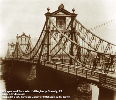
View toward North Side 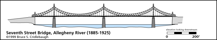
Elevation drawing looking downstream 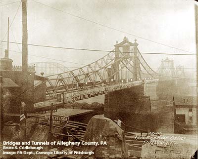
View toward North Side, Sixth St Bridge at left OFFICIAL NAME: Seventh Street Bridge OTHER DESIGNATION: Irvine (Irwin) Street Bridge LOCATION: Pittsburgh USGS 7.5" Topo Quad - UTM Coordinates: Pittsburgh West - Zone 17; 0584 4477 CARRIED: motor vehicles BETWEEN: -- Sandusky St on right descending bank of Allegheny River -- Seventh St [Irvine/Irwin St] on left descending bank of Allegheny River CROSSED: -- Allegheny River at mile 0.6 TYPE OF CONSTRUCTION / DESIGN: Suspension - - catenaries were steel eyebar chain arranged in concentric pairs connected by lattice girders steel eyebar suspenders LENGTH OF MAIN SPAN: two main spans, 320 ft; two side spans, 165 ft TOTAL LENGTH (including longest elevated ramp): 970 ft HEIGHT OF DECK: YEAR ERECTED / ENGINEER: 1885, Gustav Lindenthal; replaced 1925 ADDITIONAL INFO: A two-span suspension bridge which had truss-bracing on catenaries holding two eyebar-chain cables in concentric arcs. This bridge was designed by Gustav Lindenthal three years after he built the Smithfield Street Bridge. Declared a toll-free bridge 16 March 1911. Seventh St was formerly Irvine St (or Irwin St) in Pittsburgh; it aligns with Sandusky St in the former city of Allegheny (Northside). view page - "Three Sisters" Bridges -- Historic American Engineering Record document FIELD CHECKED: INFO SOURCES: HAER; Lorant, "Pittsburgh"; Smith, "Pittsburgh: Then and Now" Submit info or inquiry - share some facts or ask a question. Introduction -- Nearby Structures Page created: Last modified: 07-Dec-2000 |
View Larger Map 
| |
| copyright: © Bruce S. Cridlebaugh 1999-2008 All Rights Reserved | |||