| Home > All By Location regional map > Oakdale > Main St over Montour Run | |||
|
|
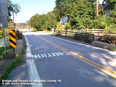
View east More detail photos OFFICIAL NAME: OTHER DESIGNATION: Main St over Montour Run LOCATION: Findlay - North Fayette USGS 7.5" Topo Quad - UTM Coordinates: Oakdale - Zone 17; 0564 4478 CARRIES: Main St BETWEEN: -- west of intersection of Steubenville Pike - Enlow Rd and Cliff Mine Rd CROSSES: -- Montour Run TYPE OF CONSTRUCTION / DESIGN: reinforced concrete beam (original span: riveted steel plate girder) abutments: locally-quarried sandstone, rock-faced coursed ashlar LENGTH OF MAIN SPAN: 32 ft TOTAL LENGTH (including longest elevated ramp): ft HEIGHT OF DECK: YEAR ERECTED / ENGINEER: 1883, Allegheny County Charles Davis, engineer deck replaced, 1950 ADDITIONAL INFO: During years surrounding 1900, Allegheny County, under the direction of County Engineer Charles Davis, was busy throughout the county building stone arch bridges of a simple and similar design. In some places, however, the crossings were built as riveted plate girder spans. The abutments of these girder bridges exhibit similar stonework to the County's stone bridges -- helping to identify their place in time and origin. A glance at the construction dates indicates that many of the earlier bridge were of the girder type. One possible explanation for the choice of an arch span versus a girder span may be found in the shape of the land onsite. Where the stream has high banks and can therefore hold rising waters of a flash flood, the bridges are usually stone arches. In places with relatively wide, flat channels, the spans are most often girders. In each instance, the goal was to maintain the level of the road surface as the road approaches and then enters the bridge -- while allowing maximum potential stream flow; sites which made this impractical have since been regraded or replaced. The lattice railing appears on other Allegheny County-built bridges. Only one of those structures has a builder's plate; that date is stated as 1940. This implies that the bridge span was replaced at that time, while the original stone abutments remain in place. The former Montour Railroad parallels Steubenville Pike here. Adjacent upstream is a riveted girder bridge. The railroad right-of-way has been converted to the Montour Trail bike path. FIELD CHECKED: 27-Oct-2003 INFO SOURCES: field check Submit info or inquiry - share some facts or ask a question. Introduction -- Nearby Structures Page created: 19-Nov-2003 Last modified: 19-Dec-2008, 19-Nov-2003 |
View Larger Map 
| |
| copyright: © Bruce S. Cridlebaugh 1999-2008 All Rights Reserved | |||