| Home > All By Location regional map > McKeesport > McKeesport-Reynoldton Bridge 1884 | |||
|
|
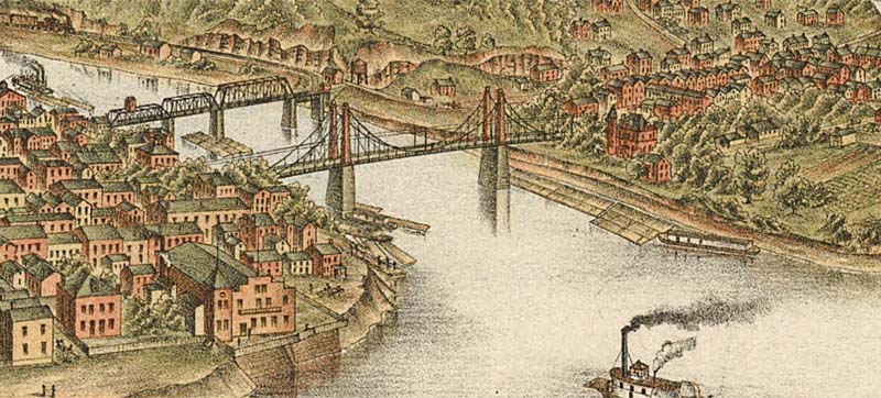
1893 drawing (suspension bridge) 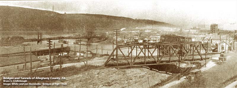
1928 photo (suspension bridge in background) OFFICIAL NAME: OTHER DESIGNATION: McKeesport-Reynoldton Bridge Third Av Bridge LOCATION: McKeesport - Reynoldton USGS 7.5" Topo Quad - UTM Coordinates: McKeesport - Zone 17; 0595 4467 CARRIED: motor vehicles, street railway BETWEEN: -- Water St, McKeesport -- Rebecca St, Reynoldton CROSSED: -- (RDB to LDB) Youghiogheny River at mile 0.2; River Rd TYPE OF CONSTRUCTION / DESIGN: Suspension LENGTH OF MAIN SPAN: 644 ft TOTAL LENGTH (including longest elevated ramp): HEIGHT OF DECK: YEAR ERECTED / ENGINEER: 1884, McKeesport and Reynoldton Bridge Company ADDITIONAL INFO: A bridge was chartered at Third Av in 1865, but construction was contested by rivermen. The bridge was delayed until 1884. A (Fowler) panoramic map dated 1883 shows a bridge at this location which does not appear to be this suspension bridge. Perhaps the drawing was done in anticipation. The 1893 Krebs pano map shows the suspension bridge. FIELD CHECKED: INFO SOURCES: Abbott, et al, "First one hundred years of McKeesport"; Beal, Ronald L., "McKeesport Trolleys: A Piece of the Past"; Krebs, Otto, panoramic map of McKeesport, 1893; 1900 Hopkins map Submit info or inquiry - share some facts or ask a question. Introduction -- Nearby Structures Page created: Last modified: 25-Oct-2000 |
View Larger Map 
| |
| copyright: © Bruce S. Cridlebaugh 1999-2008 All Rights Reserved | |||