| Home > All By Location regional map > Mars > PA Turnpike over tributary of Brush Creek | ||||
|
|
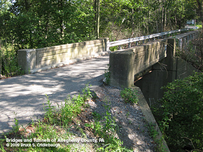
Nearby Turnpike service road from Warrendale Rd over Brush Creek
OFFICIAL NAME: WB-403A PENNDOT BMS NUMBER: - OTHER DESIGNATION: PA Turnpike over tributary of Brush Creek, at Warrendale Toll Plaza LOCATION: Marshall Twp. LATITUDE, LONGITUDE: 40.655228, -80.071256 USGS 7.5" Topo Quad - UTM Coordinates: Mars - Zone 17; 0577 4500 CARRIES: -- PA Turnpike [I-76], Warrendale Mainline Toll Plaza 31 lanes at toll plaza BETWEEN: -- MP30 CROSSES: -- tributary of Brush creek TYPE OF CONSTRUCTION / DESIGN: culvert LENGTH OF MAIN SPAN: TOTAL LENGTH (including longest elevated ramp): HEIGHT OF DECK: 1950 culvert length 84 ft; 2003 culvert length: 492 ft YEAR ERECTED / ENGINEER: 1951, Buchart Horn engineers for Western Extension Pennsylvania Turnpike Commission Reconstructed 2003, as part of Warrendale Mainline Toll Plaza, Mosites ADDITIONAL INFO: The photos shown here are of a service road linking the Turnpike with Warrendale-Bakerstown Rd. A small deck stringer bridge crosses Brush Creek southwest (downstream) from the Turnpike crossing of Brush Creek. The latter, a culvert having been completely reconstructed as part of the Warrndale Toll Plaza, is not easily accessible. FIELD CHECKED: 26-Aug-2009 INFO SOURCES: field check Submit info or inquiry - share some facts or ask a question. Introduction -- Nearby Structures Page created: Last modified: 03-Sep-2009 No warranty whatsoever -- express or implied -- as to the accuracy, reliability or completeness of furnished data. |
View Larger Map 
| ||
| copyright: © Bruce S. Cridlebaugh 1999-2009 All Rights Reserved | ||||