| Home > All By Location regional map > Glassport > Piney Fork Rd Tunnel | ||||
|
|
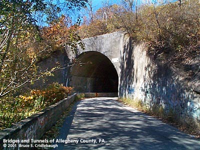
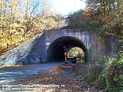
Eastern portal
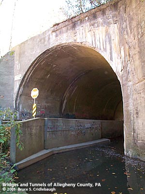
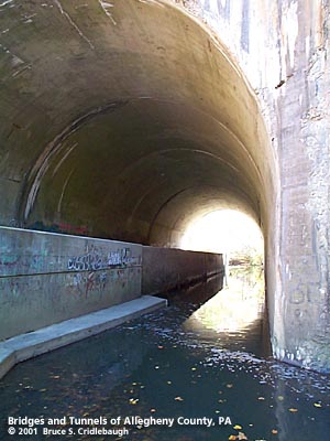
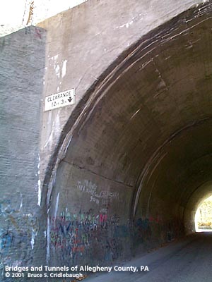
OFFICIAL NAME: OTHER DESIGNATION: Piney Fork Rd Tunnel glas587-38 LOCATION: South Park Twp (Snowden) USGS 7.5" Topo Quad - UTM Coordinates: Glassport - Zone 17; 0587 4458 CARRIES: -- Piney Fork Rd -- Piney Run BETWEEN: -- Snowden Rd UNDER: CSX [B&O RR] TYPE OF CONSTRUCTION / DESIGN: vertical wall horseshoe profile, filled concrete arch, through filled embankment TOTAL LENGTH: 176.5 ft OTHER DIMENSIONS: 40 ft wide; 20 ft roadway, 20 ft stream 12 ft 3 in posted clearance 7 ft from road surface to spring line of arch 13 ft from stream surface to spring line of arch 33 ft est to top of arch rise YEAR OPENED / ENGINEER: ADDITIONAL INFO: The Wheeling, Pittsburgh & Baltimore Railroad, 66.5 miles long through Wheeling and Wheeling Junction (Glenwood on the Monongahela River), was begun in 1851. The line between Wheeling and Washington, PA, was completed and opened for traffic prior to 1857. The line from Washington, PA, and Wheeling Junction was completed in sections as a narrow gauge railroad, and was standardized in 1883. Ferry service over the Monongahela River was maintained to West Homestead (Glenwood) until 1884 when the first bridge at Wheeling Junction was completed. The line was incorporated into the Baltimore & Ohio Railroad, later becoming part of CSX. This tunnel is also known as "Corvette Tunnel." The adjacent tunnel, formerly the link between the PRR Peters Creek Branch and the Montour RR, is said to be the haunted "Greenman's Tunnel." FIELD CHECKED: 08-Oct-2001 INFO SOURCES: "Railroads of the Pittsburgh district: a part of the Pittsburgh plan," Citizens Committee on City Plan of Pittsburgh, 1923. Submit info or inquiry - share some facts or ask a question. Introduction -- Nearby Structures Page created: Last modified: 09-Oct-2001 |
View Larger Map View Larger Map 
| ||
| copyright: © Bruce S. Cridlebaugh 1999-2008 All Rights Reserved | ||||