| Home > All By Location regional map > Braddock > PRR Plum Creek Branch Tunnel | ||||
|
|
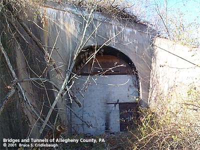
Eastern portal
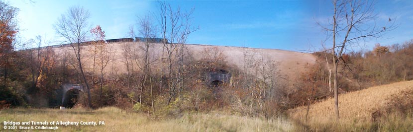
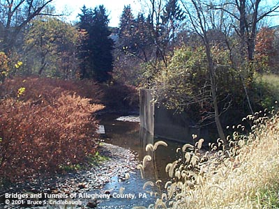
OFFICIAL NAME: OTHER DESIGNATION: PRR Plum Creek Branch Tunnel LOCATION: Plum USGS 7.5" Topo Quad - UTM Coordinates: Braddock - Zone 17; 0602 4483 CARRIES: -- former Pennsylvania RR Plum Creek branch (tracks removed) BETWEEN: UNDER: Bessemer & Lake Erie RR TYPE OF CONSTRUCTION / DESIGN: vertical wall horseshoe profile, filled concrete arch, through filled embankment TOTAL LENGTH: OTHER DIMENSIONS: 16 ft wide YEAR OPENED / ENGINEER: c1903, Pennsylvania Railroad ADDITIONAL INFO: The top of the date molded in the concrete at the top of the arch on the eastern portal is broken. The embankment fill which carries the Bessemer & Lake Erie is approximately 120 feet high and about 1,100 feet long. The B&LE was completed in 1897. But the date on the nearby Plum Creek tunnel, whether 1937 or 1957, indicates changes from the original construction. This Pennsylvania Railroad tunnel through the embankment carried the Plum Creek Branch. The 7.5 mile branch was contructed by the Allegheny Valley Railroad Company in 1872 and extended eastward to the mines at Renton after 1903. The PRR tunnel is similar in design to a 1924 structure on the Peters Creek Branch. In some locations, railroads would cross valley like this one at Plum Creek on a high trestle to complete the line -- then return to strengthen or replace the temporary structures. The B&LE replaced its 1897 high bridge over the Allegheny River in 1918; a large part of the approach trestle on the northern end was buried by an embankment. Perhaps that is what occurred here. Meeting the B&LE RR at Unity Junction at the north end of the embankment, the Unity RR roughly paralleled the Pennsylvania RR branch line. The Unity RR stayed high to the north side of the valley; the PRR follwed the water level along the south side of Little Plum Creek. The two rail lines meet near New Texas before continuing to the Renton mines. This part of the PRR line (south and east of Unity Junction) was an extension of the Plum Creek Branch which followed Plum Creek from Verona (connecting to the Allegheny Valley RR) along the border of Plum and Penn Hills (Penn Twp) to the mining towns of Unity, Center and Trestle. The Plum Creek Railroad is shown as a separate company on the 1876 and 1903 maps. Other bridges on the Unity RR line are noted as being built in 1918 and 1925. The PRR tunnel has been sealed at each end and is apparently used as a private garage / storage shed. view page - Railroad History FIELD CHECKED: 22-Oct-2001 INFO SOURCES: Submit info or inquiry - share some facts or ask a question. Introduction -- Nearby Structures Page created: Last modified: 06-Sep-2001 |
View Larger Map 
| ||
| copyright: © Bruce S. Cridlebaugh 1999-2008 All Rights Reserved | ||||