Field Notes:
Bigelow Boulevard, Pittsburgh, PA
In response to an e-mail inquiry:
> > I am looking for some history regarding Bigelow Boulevard, Pittsburgh, PA. < <
The 3-mile boulevard was built to connect the new Schenley Park with the downtown Triangle. Grant Boulevard was the beginning of an 11-1/2 mile drive which included Beechwood and Washington Blvds in a promenade connecting downtown with Bigelow's two new parks (1889): Schenley and Highland.
Edward Manning Bigelow, known as the "father of Pittsburgh's parks," was appointed City Engineer in 1880. The position was transformed in 1888 into Director of Public Works and during his tenure of over thirty years, Bigelow forged major improvements in boulevards, waterworks, and parks. He quietly began his efforts to acquire land in various parts of the city for public park use. This was at a time when only the wealthy had significantly large amounts land around their homes. The only public park was a block long area in Second Avenue between Grant and Ross streets downtown -- now the ramp of the Blvd of the Allies. He assembled the lands which became Schenley and Highland Parks. (In summer 2002, PNC purchased the Pittsburgh Public Safety Bldg at Allies and Grant...to tear it down and create a park in front of their Operations Center. De ja vu all over again.)
From Lorant's "Pittsburgh":
July 1, 1900: Grant Boulevard (Bigelow Boulevard), a "rapid transit" road to the east, conceived in 1891 by E.M. (Edward Manning) Bigelow (d. 1916) and cut out of the side of Bedford Hill, was opened to traffic after three years of work.
In 1904 the Pgh Chamber of Commerce led the fight against allowing the Pittsburgh Railways to lay street car tracks on the boulevard. The franchise had been given by the council and mayor, but was later rescinded.
There are many references to Grant Boulevard in the 1910 Fredrick Law Olmsted report.
The 1912 phase of the removal of the Grant's Hill "Hump" lowered the elevation of downtown streets near the courthouse by up to 16.3 feet. Grant Boulevard was extended from Seventh Av to Webster Av.
The success of Grant Boulevard (as measured by the increased development of Schenley Farms and the traffic congestion of the roadway) prompted the 1913 Planning Commission to push for the construction of Monongahela Blvd -- later Blvd of the Allies. They also pressured the Pennsylvania RR to construct a pedestrian underpass between the PA Station and the Pan Handle RR tracks, due to the many accidents at the Washington Place footbridge at Grant Blvd. Motorists were speeding through the area to get a good run at the long eastbound hill.
From Lorant's "Pittsburgh":
November 8 to 18, 1920: Repeated landslides occurred below Bigelow Boulevard as rainfall continued; engineers waged a losing fight in their efforts to stop the slides and protect Pennsylvania Railroad tracks.
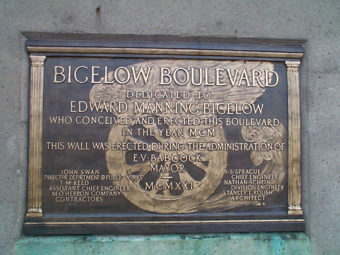
Here is a photo of a plaque erected as part of the 1921 repairs.
From Lorant's "Pittsburgh":
June 19 1939: State Supreme Court upheld a verdict awarding $800,000 to Pennsylvania Railroad for damages against the city as a result of 1920 Bigelow Boulevard landslide.
As the PRR expanded at the base of the cliff (below the boulevard), the railroad property took over a number of streets including Quarry St. The cliff had been quarried for Morgantown sandstone (about halfway up from the base, 150 ft above river level), and layers of limestone and coal (Summerville/Lower Pittsburgh Limestone, Pittsburgh Coal and Upper Pittsburgh Limestone show along Bigelow Blvd ascending the top 150 ft of Bedford Hill).
The retaining wall on the south side of the road would be an interesting archeological project. It has been built and rebuilt in many stages. There are remnants of the Penn Incline between 17th St in the Strip and Ledlie St on the Hill. A 1936 photo shows one of the iterations of the wall with rusticated stone pilasters. There is no median. The lampposts are ornate but simple posts with a single lamp.
A photo taken for the December 13, 1939 reopening shows a low concrete median, no center rail, and new, taller lampposts in the median. More recently, the original fixtures have, of course, been replaced by "modern" lamp arms.
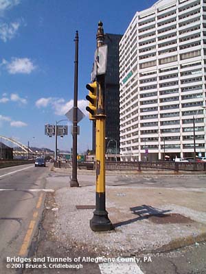
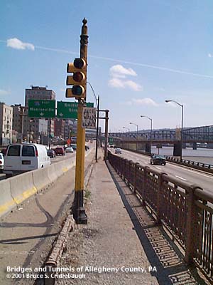
Samples of this 1940 style of lamppost were visible on Fort Pitt Blvd until the fixtures and eastbound roadway was removed in Summer 2002:
Sample 1 -
Sample 2
The Crosstown Boulevard era severely altered the downtown end of the Boulevard. The bridge carrying Bigelow over the Crosstown to Seventh Av was built in 1960, while most of the rest of the Crosstown bridges and ramps were finished in 1962. Photos on Adam Prince's Ghost Ramp webpage show some of the results. The Crosstown Blvd connection to the Veteran's Bridge was built in 1986.
Submit info or inquiry - share some facts or ask a question.
Page created:
Page created:
12-Apr-2000
Last modified:
12-Apr-2000